
Is Bowness in a Flood Zone? A Property-by-Property Guide for Calgary Buyers and Sellers
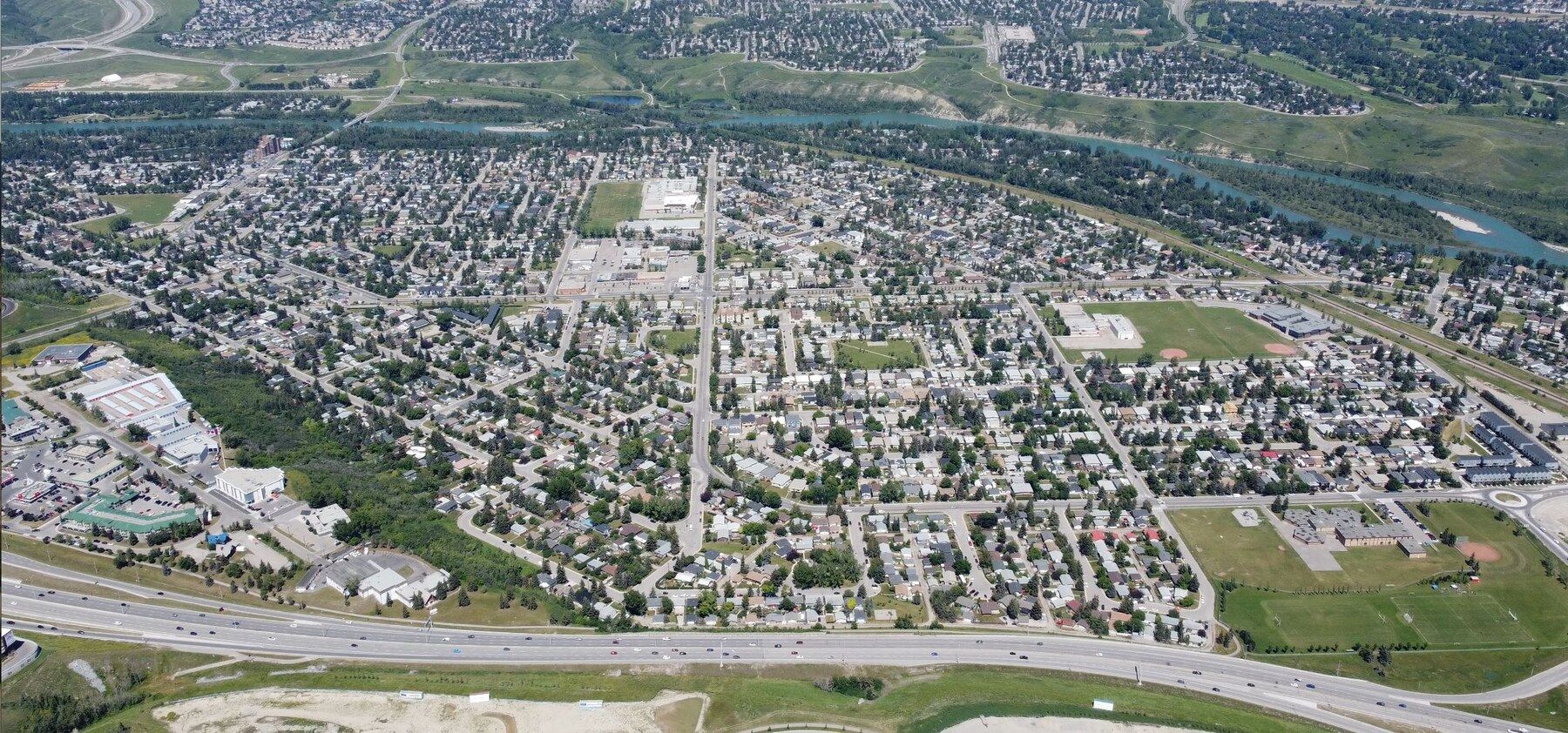
Actual aerial view of Bowness, Calgary, photographed in August 2022. Photo: Redstar3000 / Thomas Currie, CC BY-SA 4.0; resized for web.
Is Bowness in a Flood Zone? A Property-by-Property Guide for Calgary Buyers and Sellers
Updated August 6, 2026 · By Ryan Parry, REALTOR®
Bowness is one of Calgary’s most distinctive river communities—but it does not have one single flood-risk rating. Risk can change from one property to the next based on elevation, proximity to the Bow River, groundwater conditions, building design and floodproofing.
The short answer: Some low-lying parts of Bowness are within mapped flood-hazard areas, while many properties are outside them. No home should be labelled “safe,” “high risk” or “flood-free” without checking its exact address and building characteristics.
What happened in Bowness during the 2013 flood?
The June 2013 flood followed heavy mountain rainfall falling onto a melting snowpack. Calgary evacuated approximately 80,000 people, including residents in low-lying portions of Bowness. The City reports that Bow River flows peaked at approximately 2,400 cubic metres per second at the confluence—about eight times the river’s normal flow.
Bowness was among the communities placed under mandatory evacuation on June 20, 2013. Depending on location, properties experienced different combinations of overland river water, high groundwater, foundation seepage, sewer-related problems and riverbank erosion.
The lesson is not that every Bowness home flooded, or that every affected home remains compromised. The lesson is that the history, repair work and present-day protection of the individual property matter.
Which parts of Bowness are most vulnerable?
City modelling identifies two particularly low-lying areas along the Bow River:
- East of Bow Crescent toward 67 Street NW: Depending on location and conditions, the river can begin entering low areas at modelled flows of approximately 690–800 m³/s.
- East of 60 Street NW toward Hextall Bridge: Water can begin spreading into low areas at approximately 830 m³/s.
At a modelled flow of approximately 1,230 m³/s, the City previously identified roughly 160–180 properties and pieces of community infrastructure as potentially exposed to overland flooding. These are planning-model results—not a forecast that every identified property will flood in a future event.
The three risks buyers should understand
1. Overland river flooding
This occurs when river water leaves the channel and travels across normally dry land. It is the risk most people picture when they hear “flood zone.”
2. River-related groundwater
During high river flows, groundwater can rise beneath nearby properties and enter basements through foundations, joints or floor systems—even where river water never travels across the yard. Calgary’s newer groundwater study suggests this residual risk can extend beyond the mapped overland flood area.
3. Sewer backup, stormwater and ordinary seepage
Sewer backup and intense-rain drainage problems are different from overland river flooding. They can occur inside or outside a river flood zone and may require different insurance endorsements and property protections.
How to check a specific Bowness address
Use both official mapping systems because they answer different questions:
- City of Calgary Regulatory Flood Map: This identifies the current floodway, flood fringe and overland-flow areas connected to Calgary’s Land Use Bylaw and development rules. Open the City flood-map page.
- Alberta Flood Awareness Map: Search an exact address and explore hazard, inundation, range and likelihood information for different modelled events. Open the Alberta map.
A “1-in-100-year flood” does not mean flooding happens only once every century. It means a 1% chance in any given year. Mathematically, that is roughly a 26% chance of at least one such event over a 30-year period, assuming the annual probability remains constant.
Important 2026 map update: Newer provincial mapping and proposed City regulations introduce High Hazard Flood Fringe, Protected Flood Fringe and Groundwater Flood Fringe categories. Calgary Council did not adopt the proposed bylaw amendments in April 2026; they were referred back for additional community engagement. Existing bylaw mapping still governs current development applications, while newer maps provide additional risk information.
What flood protection exists today?
Calgary has invested heavily in forecasting, riverbank protection, pump stations, barriers and upstream storage since 2013. The City estimates these measures have reduced expected citywide damages from a 2013-sized event by about 70%. That is a Calgary-wide figure and should not be interpreted as a 70% reduction for every Bowness property.
For the Bow River, Alberta’s agreement with TransAlta provides additional flood-season storage at Ghost Reservoir. The City’s current resilience plan says the agreement runs through 2031. This can reduce flood peaks, particularly during smaller events, but it does not eliminate the possibility of a major Bow River flood.
Alberta is also studying a relocated Ghost Dam as a longer-term flood- and drought-management project. It remains a proposed project—not completed protection—and should not be built into a purchase decision as guaranteed future infrastructure.
What about the proposed Bowness flood barrier?
The City studied a technically feasible 1.9-kilometre barrier along low-lying portions of Bow Crescent. The concept would have crossed approximately 75 private riverfront properties and required negotiated easements. The City is not currently proceeding with design or construction and reports that there is no assigned project team or funding. Buyers should not be told that a permanent Bowness barrier is approved or guaranteed.
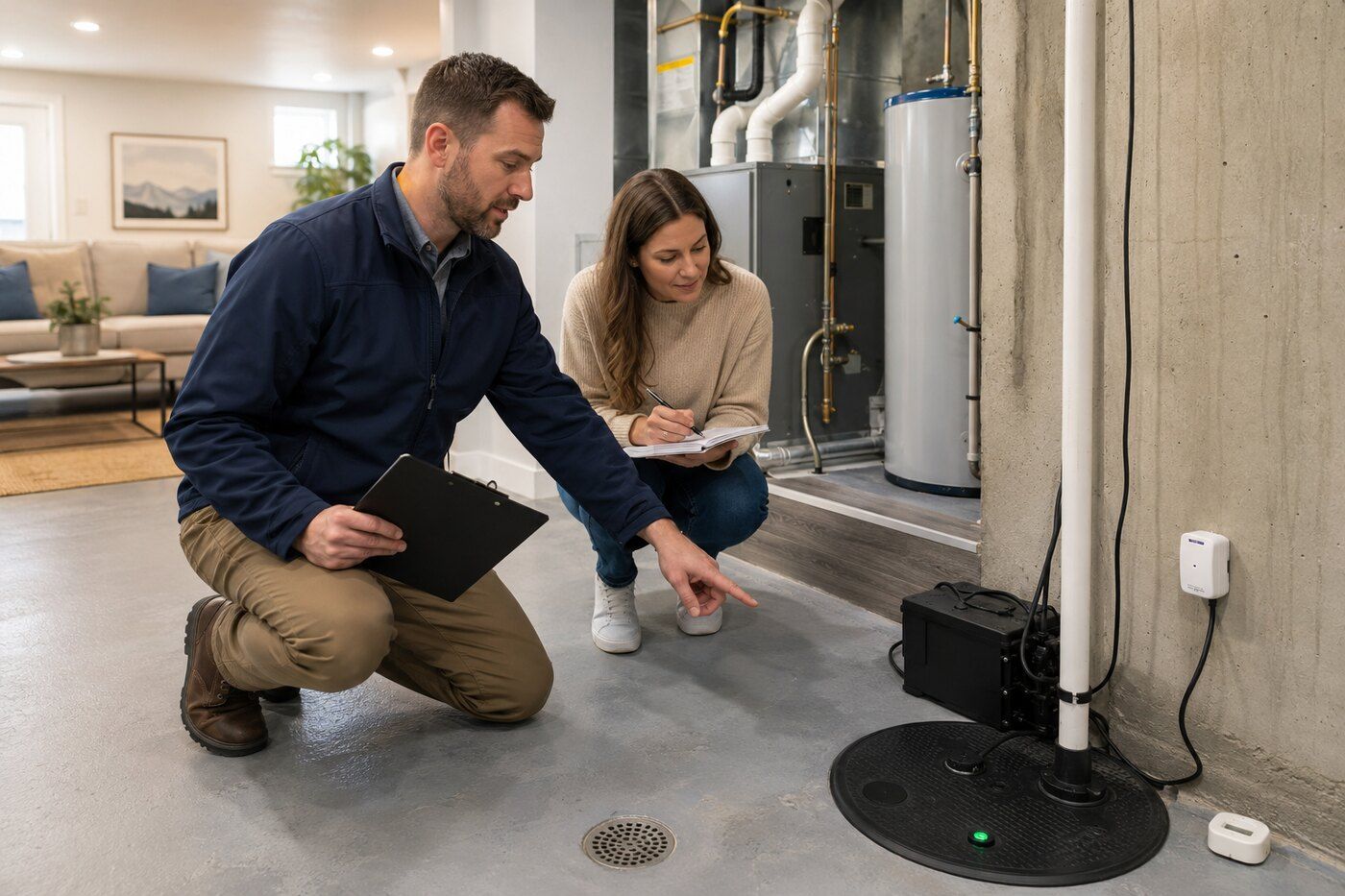
Property-level protection and a specialized inspection can be as important as the map designation.
A buyer’s Bowness flood due-diligence checklist
- Search the exact address on both the City and Alberta maps.
- Call 311 for the current regulatory classification, official flood elevation, recommended flood elevation and development implications.
- Request a property-specific insurance quote before removing conditions.
- Ask separately about overland water, sewer backup, groundwater, seepage, deductibles and coverage limits.
- Ask the seller in writing about all past water events, their causes, claims, repairs and remediation.
- Review permits, invoices, photographs, engineering reports and warranties.
- Use a licensed inspector familiar with older Calgary homes and flood-affected properties.
- Consider moisture, mould, foundation, electrical and sewer-scope specialists where warranted.
- Check the sump pump, battery backup, backwater valve, grading, downspouts, foundation waterproofing and location of mechanical equipment.
- Confirm redevelopment possibilities with the City before assuming an existing home can be replaced or substantially enlarged.
What should a Bowness seller prepare?
A well-organized seller can replace uncertainty with credible documentation. Gather any available:
- 2013 or subsequent repair records and photographs
- Insurance and disaster-assistance documents
- Professional remediation or mould-clearance reports
- Building, plumbing, electrical and basement-development permits
- Invoices for sump pumps, backwater valves, waterproofing and grading
- Engineering, foundation and drainage reports
- City correspondence concerning flood elevations or development
Alberta real-estate licensees must disclose known material latent defects affecting a property. Sellers should answer questions honestly and obtain legal advice when the scope of a disclosure obligation is unclear.
Will insurance cover flooding?
Never assume that a standard policy covers every kind of water damage. Sewer-backup coverage and overland-water coverage are commonly optional. Groundwater and seepage wording varies considerably by insurer, property and policy.
Government maps may also differ from an insurer’s proprietary risk model. The safest approach is to obtain a written quotation for the exact address and have the buyer confirm that the proposed policy satisfies their lender.
Frequently asked questions
Did all of Bowness flood in 2013?
No. Impacts varied by location, elevation, building and source of water. Low-lying and river-adjacent areas were particularly vulnerable, but the whole community should not be described as having flooded.
Is a home outside the flood map completely safe?
No map can guarantee that. Groundwater, sewer backup, intense rainfall, drainage issues and events larger than the mapped scenario can still create risk.
Is the permanent Bowness flood barrier being built?
Not currently. The feasibility study was completed, but the City says the project is not proceeding and has no assigned construction funding or project team.
Should buyers avoid Bowness?
That is not the conclusion supported by the evidence. Bowness offers a rare combination of character, river access, parks, local businesses and proximity to central Calgary. The right approach is informed, address-specific due diligence—not a blanket judgment about the community.
Thinking about buying or selling in Bowness?
I can help you review the property’s location, questions to ask, documents to request and professionals to consult—without exaggerating or minimizing the risk.
Official resources
- City of Calgary flood maps
- Alberta Flood Awareness Map
- Calgary River Valleys Project and 2026 mapping status
- Bowness Flood Barrier Project
- Calgary Flood Resilience Plan
- Insurance Bureau of Canada water-damage guidance
Important: This article provides general information as of August 6, 2026. It is not legal, engineering, environmental, insurance or property-specific advice. Flood maps and public policy can change. Verify an individual property through the City of Calgary, Government of Alberta, insurer, lender, lawyer and qualified inspectors.
Ryan Parry, REALTOR®
Your Bowness Family Realtor — Honest Results, Since 2004.
Categories
Recent Posts


GET MORE INFORMATION